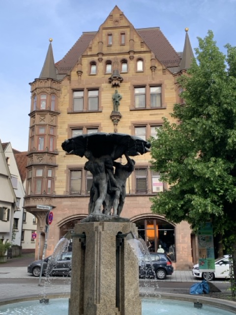
Atlantenbrunnen
The Atlantenbrunnen stands where the Platzgasse runs out, a narrow lane in a German city at the edge of the old town. You walk it with the minster at your back. In that position the fountain works as a full stop, marking where the medieval town ends and something else begins. It sits in the open air, a quiet corner made for photographs.
The change happened around 1900, when the old city wall vanished from this spot. Large buildings for trade and housing rose instead. The city pushed beyond its own boundary and built itself anew. So the fountain stands between two worlds: the medieval town at your back, the world of 1900 in front. Look closely and you find the atlantes, figures carrying a weight on their shoulders. In architecture, these figures support beams and cornices.
That town lies closer than it looks, about a hundred metres back down the same lane. The Büchsenstadel of 1485 is over five hundred years old and still in use, now as a youth centre. The Salzstadelgasse branches off here, and the Museum of Bread Culture sits inside the former Salzstadel. So many fountains stand in this town that a proper fountain route runs through the centre. This fountain is one stop on it, before the way carries on to the Georgsbrunnen and the Neptunbrunnen. A few steps further on, traces of the medieval fortifications appear in both directions. Among them are the Gräbenhäuschen, small houses lining the moat, and they exist only here.
- City
- Ulm
- Content updated
Take this page with you
The myTuur app is free, and once you are standing at a spot its story starts by itself.


Spots like this one are the stops myTuur strings into tours through Ulm. In the app, each story begins where you stand: walk up to a spot and it starts, read it on screen or listen as you go, then follow the route to the next one.
What is myTuur?
myTuur is a free city-guide app. Its tours are built from spots, and each spot carries a story that starts when you get there, to read or to listen to as you like.